
1st of OCT. 2019
At Haven City University (HCU) at Germany.
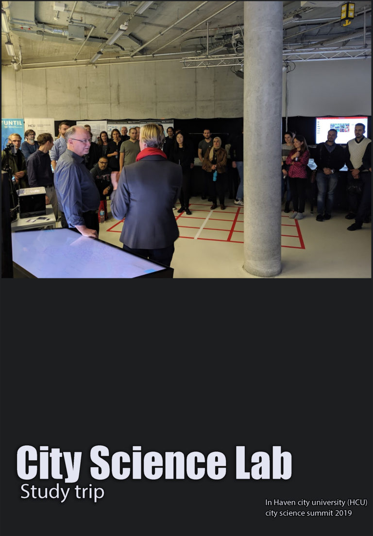
city science lab, where group of multi disciplinary researchers, academics and professionals from different countries worldwide work. This gathering was celebrating the research achievements resulted from the cooperation between MIT media lab and Hafen City University – City science lab as part of developing the international network of cooperative labs. Actually, it took place in June 2015 after Hamburg’s first mayor Olaf Scholz and the MIT media lab director Joi Ito signed a long-term research agreement promoting the creation of the City Science Lab (CSL) at HafenCity University where industry leaders and private companies cooperate to endorse research in mutual fields of interest.
Prof. Dr. Gesa Ziemer the director of the city science lab and her team in Hafen city university organized a meeting which involved almost 19 young researchers from the MIT led by prof. Kent Larson the director of a city science group in MIT media lab. They were invited to present their genuine ideas in what concerns enabling livable and high performance districts in our contemporary cities.
The lab introduced sample projects presented by groups of multi-disciplinary researchers specialized in social sciences, data and informatics, computer science, architecture and urban design. We had the opportunity to explore both practically and theoretically the digital interfaces created by the city science lab in Hamburg. The main objective was to understand the conception, development and deployment of the HCI system for public participation.
The system responded to the governmental project entitled finding places (FP) aiming to allocate refugees accommodation in the city of Hamburg. The city scape-FP tool is considered a rapid prototyping urban planning and decision-making tool. It facilitates achieving an effective communication between multiple participants and stakeholders, integrating the citizens’ local knowledge into the administrative assessment for the potential locations, in order to perform guidance for political decision-making.
The digital interface ‘City scope (CS) tool’’ was an ongoing research theme taking place at the MIT Media Lab’s changing Places Group (CPG) in the last years. ئdapting the tool for the finding places project demanded numerous alterations in different aspects, where the existed CS hardware and software were unable to achieve the scope of finding places project. The modifications targeted a networked communication between Geographic information system (GIS) and persistent data management.
A series of workshops were developed with the people to experiment the new tool. The city scope – FP set up encompassed instant image processing interpreting the user’s interaction with the tool and the simulations for these interactions into a geospatial context. The interactions occurs through the use of Lego bricks where stakeholders could pick and place over a transparent table projecting a Google earth map for a specific district and constrained by a prefabricated grid. The tool visualizes the people’s selections for refugee’s allocation areas with a complete analysis for the selected land plot according to the geospatial and statistical data offered by the system. More over it updates any changes taking place in the district after the allocation of refugees housing, accordingly all data analysis are modified on all displays.
During our visit to the city science lab we explored the potentials of digital interfaces as design aiding tools. It helps in deciding the best places to establish cultural, commercial, social or entertainment projects. It enables practitioners to understand the potential land plots with complete analytical investigations, visualizing statistical and geospatial studies. Moreover the tool enables decision makers to understand all the available opportunities and possible risks in their decisions.
Furthermore, the tool offers the possibility of overlaying different urban, environmental and social studies, which helps decision makers to understand the complexity of urban conditions and consequently choose the most appropriate solutions in relevance to the available data.